EM90 acre gauge
2025/9/25
![]()
|
performance |
Satellite receiver |
GPS+Beidou+GLONASS+QZSS |
|
antenna |
Built-in high-quality ceramic antenna |
|
|
Positioning time |
Cold start30Seconds, hot start1Second |
|
|
Positioning accuracy |
<=3> |
|
|
Trajectory measurement error |
<> |
|
|
Area measurement error |
<1><>;1~5acre:<> |
|
|
More than 5 acres:<> |
||
|
Area measurement range |
0~1000000acre |
|
|
shell |
High-strength engineering plastics |
|
|
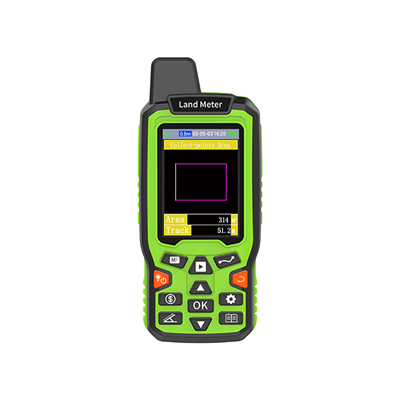
Screen |
2.4" colorTFT Highlight, resolution240*320 |
|
|
External dimensions |
155×55×25mm |
|
|
weight |
250g (including battery) |
|
|
Power supply method |
Lithium battery3.7V 3500mAH |
|
|
Working hours |
More than 8 hours |
|
|
charger |
DC 5V 1000mA |
|
|
Operating temperature |
burden20~60Degree |
|
|
Storage temperature |
burden30~70Degree |
|
|
interface |
TYPE-C |
|
|
Waterproof and dustproof |
water proof |
|
|
Units of length |
feet, miles, kilometers, meters, |
|
|
Area unit |
Square foot, acre, hectares, square meters |
|
|
Function |
Trajectory Recording |
100 records, each record is the most10000One point, each2Save a point in seconds |
|
Plot area measurement |
100 records, each record is the most10000One point, each2Save a point in seconds |
|
|
Collection of points of interest |
1000 points of interest |
|
|
Navigation method |
Straight-line navigation or compass navigation to the location of the point of interest |
|
|
Track navigation method to go along the track point to the starting point or end point |
![]()
![]()
![]()
![]()
![]()
![]()
![]()
![]()
![]()
![]()
![]()
![]()
![]()
![]()

HeFei ZhuoLin Electronic Technology Co.,Ltd. Copyright Anhui ICP No. 12007424-1Disclaimer